Mapping cars help Alabama utility identify, measure Birmingham methane leaks
Today groups released online maps showing the location and size of methane leaks from natural gas pipes beneath city streets of Birmingham, Alabama. The maps were created using Google Street View mapping cars specially equipped with technology developed by Environmental Defense Fund, Google, and Colorado State University. The cars are designed to showcase cutting-edge technologies that help operators prioritize costly pipeline repair and replacement efforts.
The utility company Spire (formerly Alagasco), which owns the pipes, has been working to replace aging, leak-prone lines throughout its system. Leaks like the ones mapped by the team don’t usually pose an immediate safety threat, but small leaks can add up. And the escaping gas – which is mostly methane – has a powerful effect on the climate, packing 84 times the warming effect of carbon dioxide over a 20-year timeframe.
SELC attorneys Keith Johnston and Christina Andreen stand in front of the specially-outfitted Google car that helpd collect data to identify methane leaks around Birmingham.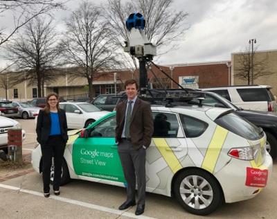
Hunting methane leaks
The Street View mapping cars collected hundreds of thousands of readings over 345 miles of roadway in selected areas of the city from March to May this year, identifying 168 leaks – in line with expectations for a system the age of Birmingham’s. According to federal databases, Spire has about 900 miles of pipe made from cast iron, bare steel, and other leak-prone materials. About 40 percent of their pipes were installed before 1970.
From 2015 to 2016, Spire cut its backlog of known leaks in pipes by 38 percent and reduced their mileage of old, cast iron pipeline mileage by 9 percent. Despite this progress, Alabama still ranks in the top fifteen states for miles of leak-prone pipe. Created from data taken over a period of months, the maps don’t paint a real-time picture. But they do reflect conditions facing Spire and dozens of other utilities, particularly in older cities.
The opportunity to deploy the unique technology developed by EDF, Google, and Colorado State University allows us to better understand issues facing our city’s energy infrastructure,” said Christina Andreen, staff attorney for SELC’s Birmingham office. “Access to this data helps to prioritize replacement of the leakiest pipes throughout Birmingham, which is a win across the board for the customer, utility, and environment.
Utilities in New York and California are already publishing dynamic maps of their natural gas leaks. Sharing geographically-attributed leak data can help regulators and ratepayers track utilities’ leak management performance, and ensure cost-efficient emission reductions. In New Jersey, the state’s largest utility is using data collected by EDF and Google Earth Outreach to maximize the environmental benefits of a $905 million pipeline replacement program.