A region, and its roads, in the crosshairs of climate change
Flooding is increasingly disrupting life all along Virginia’s coasts, and the Hampton Roads region, which includes Virginia Beach, is no exception. The region has some of the highest rates of relative sea-level rise on the entire East coast. In addition, heavy rainstorms and extreme storm surges are becoming more frequent. Perhaps most noticeable to many of the region’s residents is the increased flooding of low-lying land and streets during so-called “sunny day” or “high tide” flooding—flooding that used to happen only during severe storms but now occurs simply when steady winds or a full moon push tidal waters further inland. The Sewells Point tide gauge in Norfolk averaged only about 5 days of high-tide flooding twenty years ago but that number has nearly tripled since then, and the area could see as many as 170 days of high tide flooding—nearly half the days of the year—by 2050.
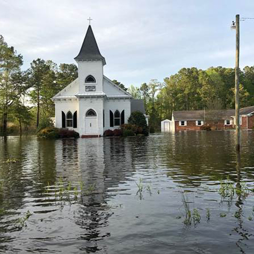
All of this flooding adds up to a daunting array of problems for residents, businesses, and visitors. One of the most difficult challenges will be figuring out what to do about the more than 200 miles of roadways in Hampton Roads that by 2040 could be routinely flooded.
Too often, decisionmakers are inclined to build a new route through undeveloped land and wetlands, rather than upgrade the existing road to make it more flood resilient. The choices made have lasting consequences for a region at the epicenter of climate change.
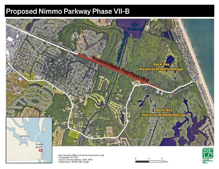
This scenario is playing out right now in Virginia Beach, where flooding occasionally closes portions of Sandbridge Road—the only public road leading in and out of the coastal community of Sandbridge. In response, the city is proposing to build a new road to provide an alternative connection to Sandbridge rather than fix the problems on Sandbridge Road. The proposed $43.7 million “Nimmo Parkway Phase VII-B” would be constructed along a strip of public land that extends eastward from the Nimmo Parkway’s current terminus. Its 1.5 mile route would cut between existing neighborhoods and through nearly a mile of the Back Bay National Wildlife Refuge, before tying into the existing Sandbridge Road corridor just west of Sandbridge.
Why the proposed road is such a flawed idea
Sandbridge Road’s vulnerability to current and future flooding is a driving force behind the proposed road. But building a new road would do nothing to help the residents along Sandbridge Road who are stranded when that road floods.
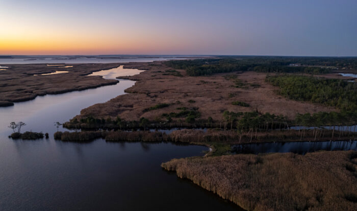
At the same time, the proposed road would bisect an extensive system of wetlands in the Back Bay National Wildlife Refuge, undermining the wetlands’ ability to absorb flood waters. During heavy storms, the several feet of fill that the proposed road would be built on top of would act much like a dike, interrupting the flow of water across these wetlands and raising flood levels—making nearby homes more vulnerable to flooding.
In addition, building the proposed road would fragment and disrupt unique wildlife habitat in the refuge that supports large concentrations of rare species.
In short, the proposed road would cause serious harm to the surrounding area, including the refuge, while leaving Sandbridge Road’s residents stranded during floods.
Better solutions deserve serious consideration
For example, building a more flood-resilient road within the existing Sandbridge Road corridor would address the flooding and safety problems that affect the road, while minimizing impacts on valuable wetlands and wildlife habitat in and near the refuge. This and other options must be explored fully before the city commits more than $40 million in taxpayer dollars to such a destructive project.
What can I do to support the best solution?
Virginia Beach officials must present the public with an unbiased study of the impacts of its proposal, along with an evaluation of alternative solutions. We expect the study to be released for public review and comment soon. We urge you to use the upcoming public comment process to raise concerns about the proposal and to call for a thorough and objective consideration of more sensible solutions, such as upgrading existing Sandbridge Road.
Learn more and receive important updates on social media:
- Back Bay Restoration Foundation on Facebook.
- Lynnhaven River NOW on Facebook, Twitter, and Instagram.
- Wetlands Watch on Facebook and Twitter.
- Southern Environmental Law Center on Facebook, Twitter, and Instagram.