What you need to know about Cainhoy Peninsula and the protective power of wetlands
What is Cainhoy Peninsula?
About 20 miles outside of Charleston, developers are proposing a nearly 10,000-acre residential development on a low-lying and flood-prone peninsula along the tidal Wando River. Much of the development would be built in wetlands that are key to protecting the higher, drier land near them.
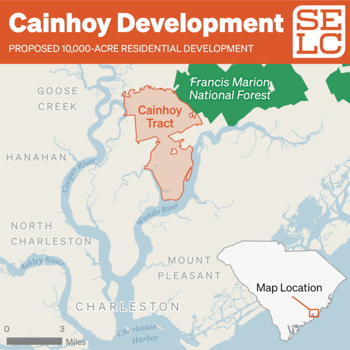
Adjacent to the Francis Marion National Forest, the Cainhoy project would destroy nearly 200 acres of freshwater wetlands, which provide critical flooding protection. An acre of wetlands holds about 330,000 gallons of water, so neighborhoods lose flood protection and homes are more likely to be damaged when wetlands are destroyed.
The Charleston area is already seeing the most dramatic impacts of sea level rise; sunny-day flooding on downtown streets is a common encounter. Officials are considering drastic solutions to protect against climate change-related flooding—such as a proposed billion-dollar seawall for downtown Charleston—yet allowing developments in wetlands like the Cainhoy project to proceed. The Southern Environmental Law Center and its partners are fighting back against this irrational and risky approach for Charleston’s future.
Why here? Why now?
Many are drawn to South Carolina’s coast by the high quality of living, easy proximity to the ocean, and favorable tax rate. But as demand goes up, the need for housing increases. And the question of where to build in a changing climate becomes more pressing.
“There are responsible ways to invest in new development for Charleston, but this is not one of them,” said Chris DeScherer, director of SELC’s Charleston office. “You’re talking about putting a small city in a floodplain a few feet above sea level.”
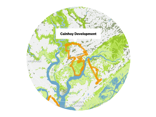
The developer’s plans would place almost half of the new homes and infrastructure on the southern end of the peninsula, which is already vulnerable to flooding and will be at an even greater risk as seas continue rising and as storms continue to become more powerful. For example, at the southern section of the Cainhoy peninsula—where thousands of houses are slated to be built in the floodplain—storm surge from a Category 1 hurricane now could swamp much of the land. And in a future with just one foot of sea level rise, that southern tract will be inundated more and more frequently. With more sea level rise, the land and the homes slated for this area would be in the water.
Want to learn more?
Working with our partners at the Coastal Conservation League, we commissioned an expert report to examine other, comparable development options with less impact to wetlands While we do not support or endorse any development of this tract, the report demonstrates that the proposed Cainhoy development submitted by the developers to the Army Corps of Engineers is not the least environmentally damaging alternative, as required by law.
Following the U.S. Army Corps of Engineer’s decision in May to finally approve the permit for the development, SELC has alerted the agency that we intend to file suit in federal court.
To see the impacts of sea level rise and the loss of wetlands in the area slated for this reckless proposal, visit TheChangingCoast.org to explore the interactive map.